iReland by iPhone – Part 1 – sTone
My interest in photography as a hobby is relatively recent. If I’m honest, despite being a bit of a ‘gadget’ person, I was always a little intimidated by the jargon of photography and felt I wouldn’t have the inclination or patience to get to grips with things like exposure, aperture, shutter speed, ISO etc, and the relationship between them all. Of course, I could have side-stepped that obstacle by getting a fully-automatic, point-and-shoot (which in the right hands will create great images), but I guess the fundamental desire wasn’t there.
That all began to change when I acquired an iPhone 4 in 2010. I discovered (more by accident than design) that with the in-built 5MP camera coupled with the beautiful ‘retina’ screen, I was able to produce some quite acceptable pictures. As a result, I became increasingly interested in what I could do with this facility on the phone. Now, all I needed was a project.
Having herself completed a Solo Photo Book Month (SoFoBoMo) entry in 2011, I was encouraged by my wife (a life-long photography enthusiast) to submit my own entry using pictures taken on my iPhone. So I decided to give it a go. The parameters I set for myself were (a) to use only pictures taken on the iPhone, (b) to take all of the pictures during my vacation between August 1st and 11th and (c) with the exception of cropping, to undertake little or no post-production on the shots. My only compromise on the last parameter was to correct the exposure on one of the shots. Otherwise, the pictures are as originally shot on the phone.
The result was a 32-page digital photo-book entitled “iReland by iPhone”. The pictures were taken during summer travels in counties Wicklow, Clare and Kerry and were presented under the following headings:
- Stone
- Sea and Sand
- Summer Flora
- Sun and Shade
In this and the following three posts, I have adapted the photos and narrative from the book for my blog.
Not content to do one project that year, I went on to complete a second SoFoBoMo project in 2011 entitled “iPhone Home” – featuring photos taken on my iPhone in and around my hometown of Bray. I will adapt that at a later date for my blog. In the meantime, I hope you enjoy this series of posts – “iReland by iPhone”.
Part 1 – sTone
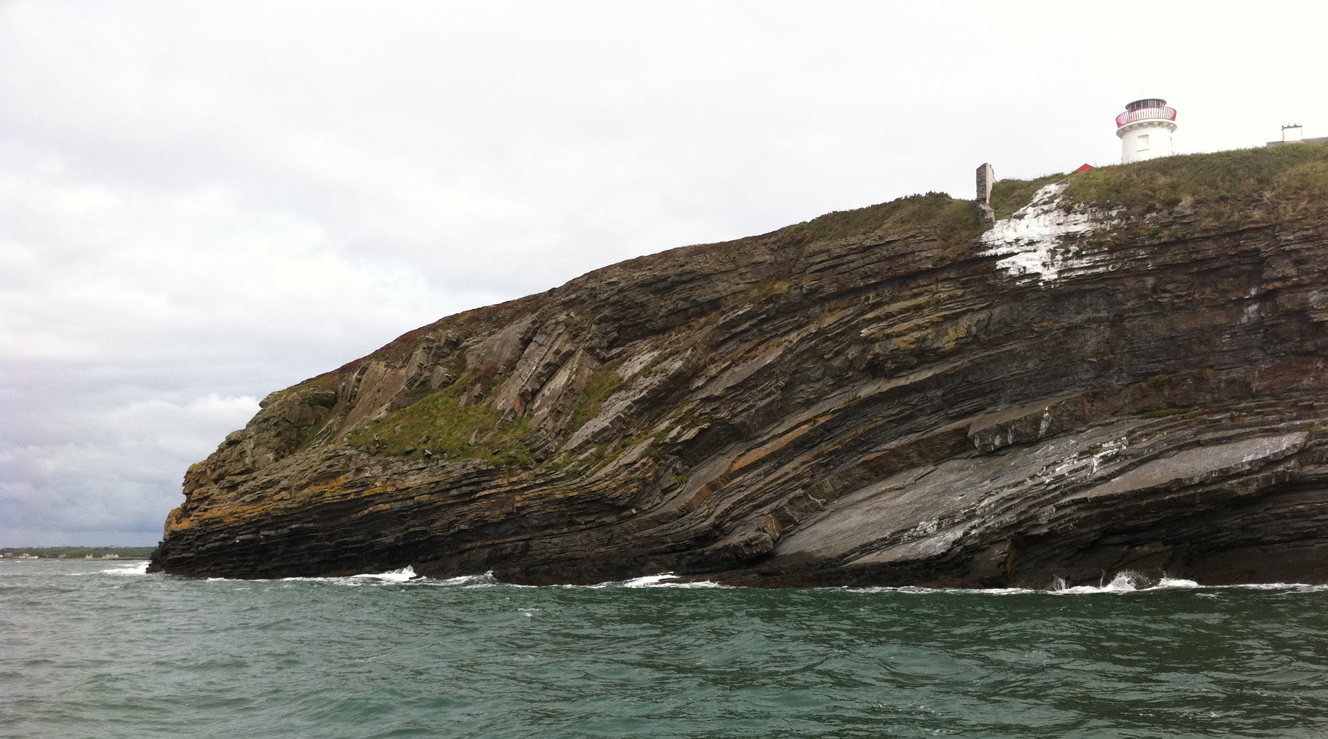
This image, taken on the north side of the Shannon Estuary, shows part of the Ross Sandstone Formation. The characteristic layering of sedimentary rock is clearly visible. The shot also shows a glimpse of the Kilcredaun Head Lighthouse. It is a round stone tower with lantern and gallery. Kilcredaun is a harbour light which serves to lead vessels to the anchorage at Carrigaholt.
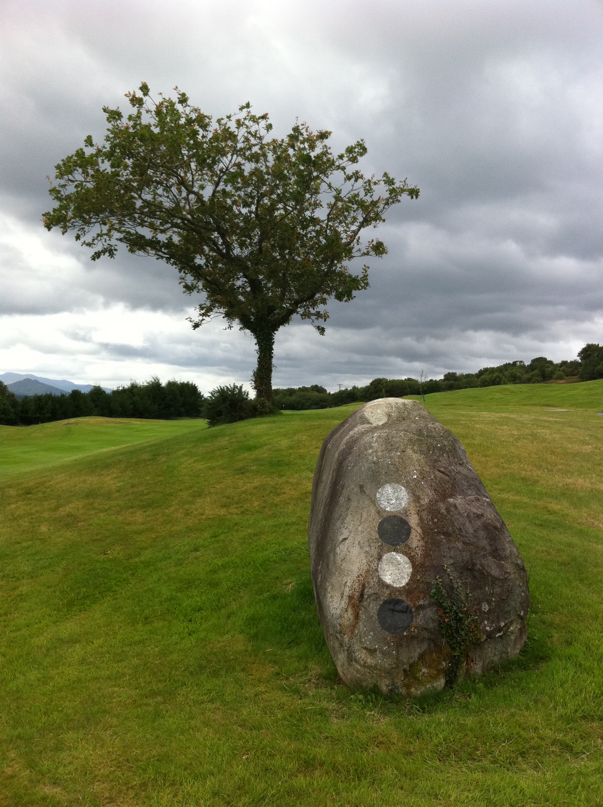
I encountered these two quite different stones on the Ring of Kerry Golf Course. The one above is in clear view as you tee off on the 16th hole but is more decorative in nature than posing any real hazard!
The stone below is at a divide in one of the walkways. It’s purpose could be as a seating place while admiring the beautiful scenery over Kenmare Bay. Or perhaps as a place to sit and ponder which path to take?

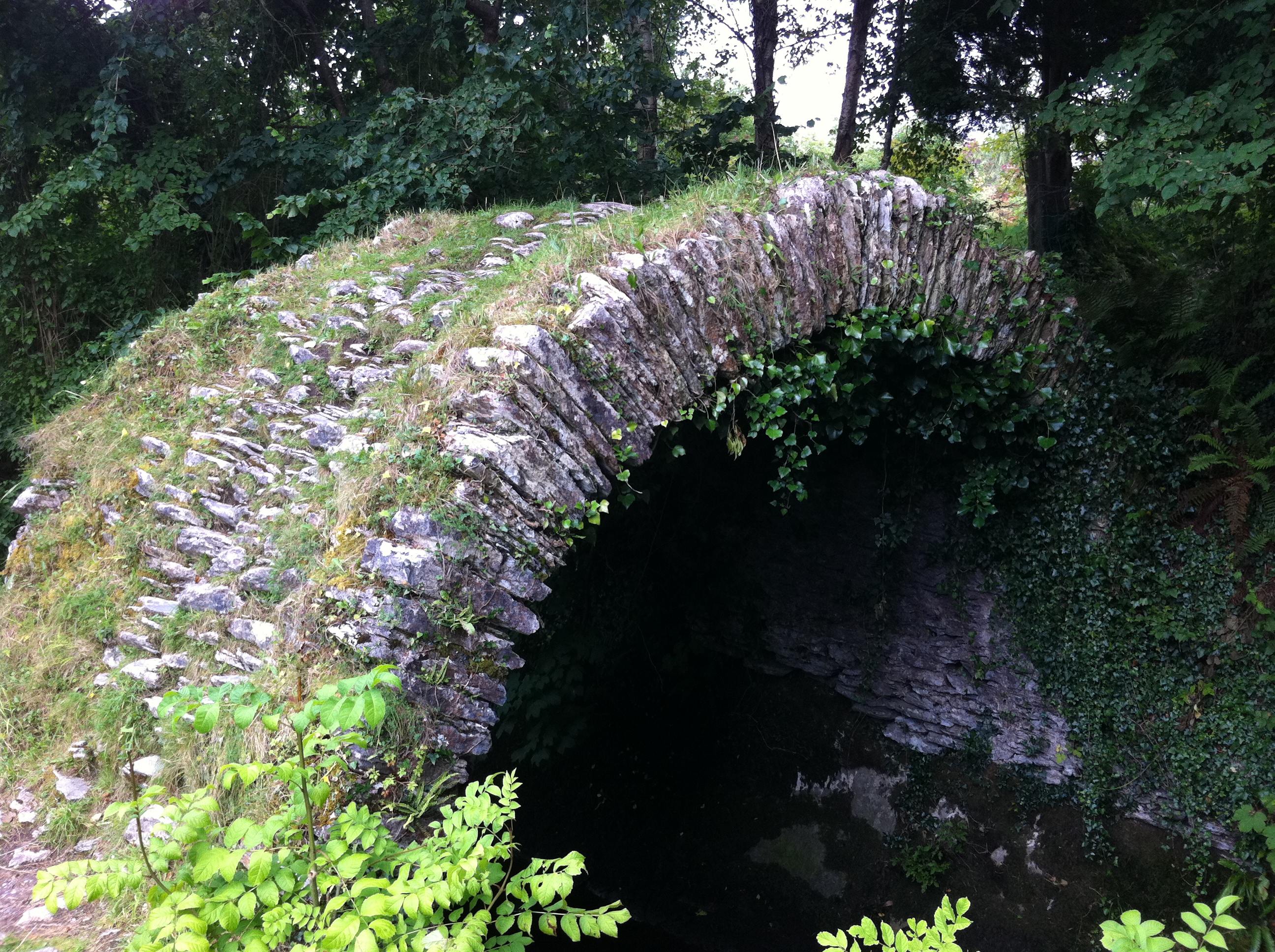
cRomwell’s bRidge (dRoichead cRomaill)
This small arched bridge, situated in the town of Kenmare, is said to be named after Oliver Cromwell, although he never came to Kerry during his Irish campaign. The name is more probably derived from the Irish word for a moustache (Croimeal), which accurately describes its shape.
The bridge was designed for pedestrian use and may have been built by the English settlers who built Kenmare in the 17th century.
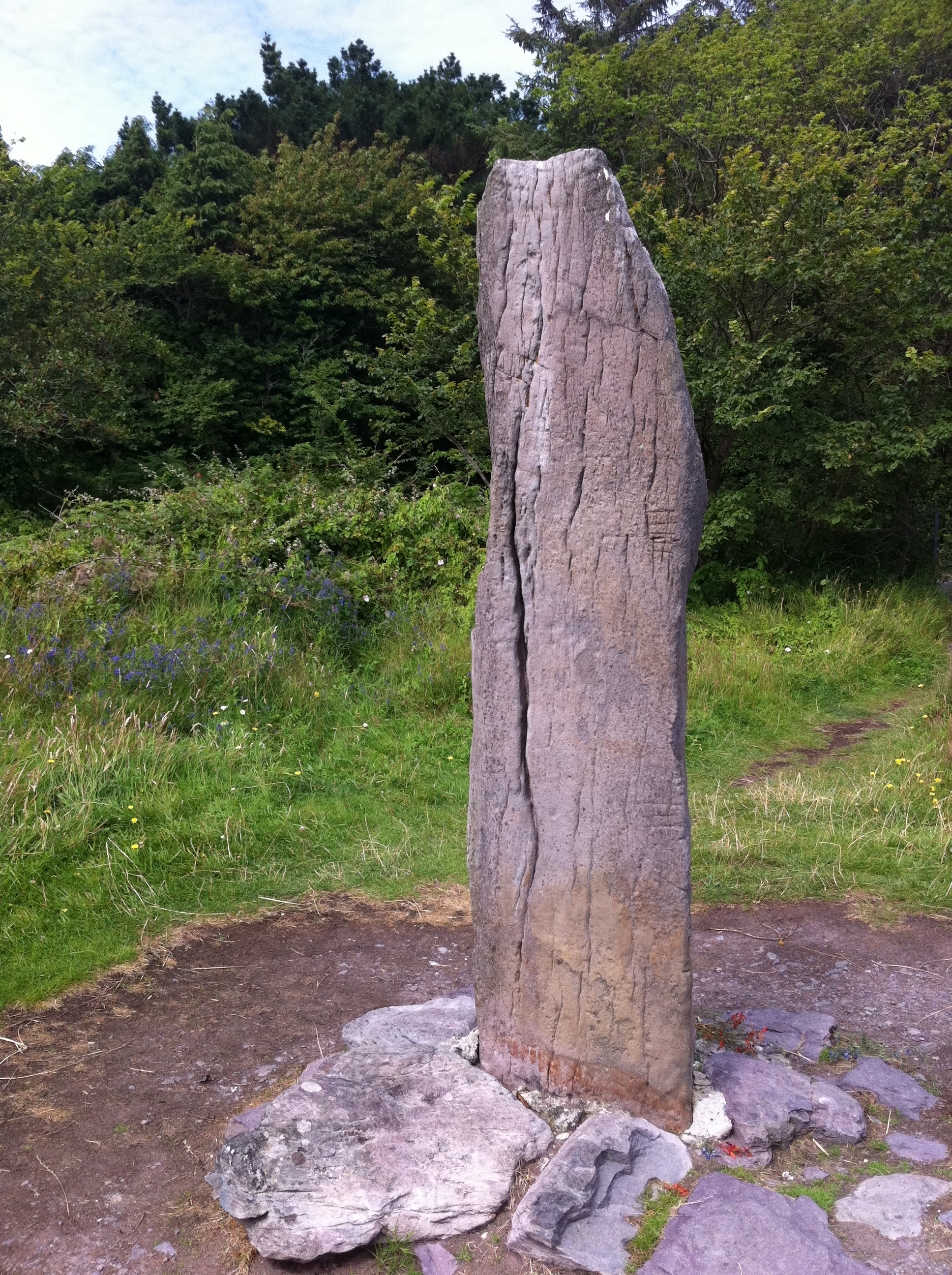
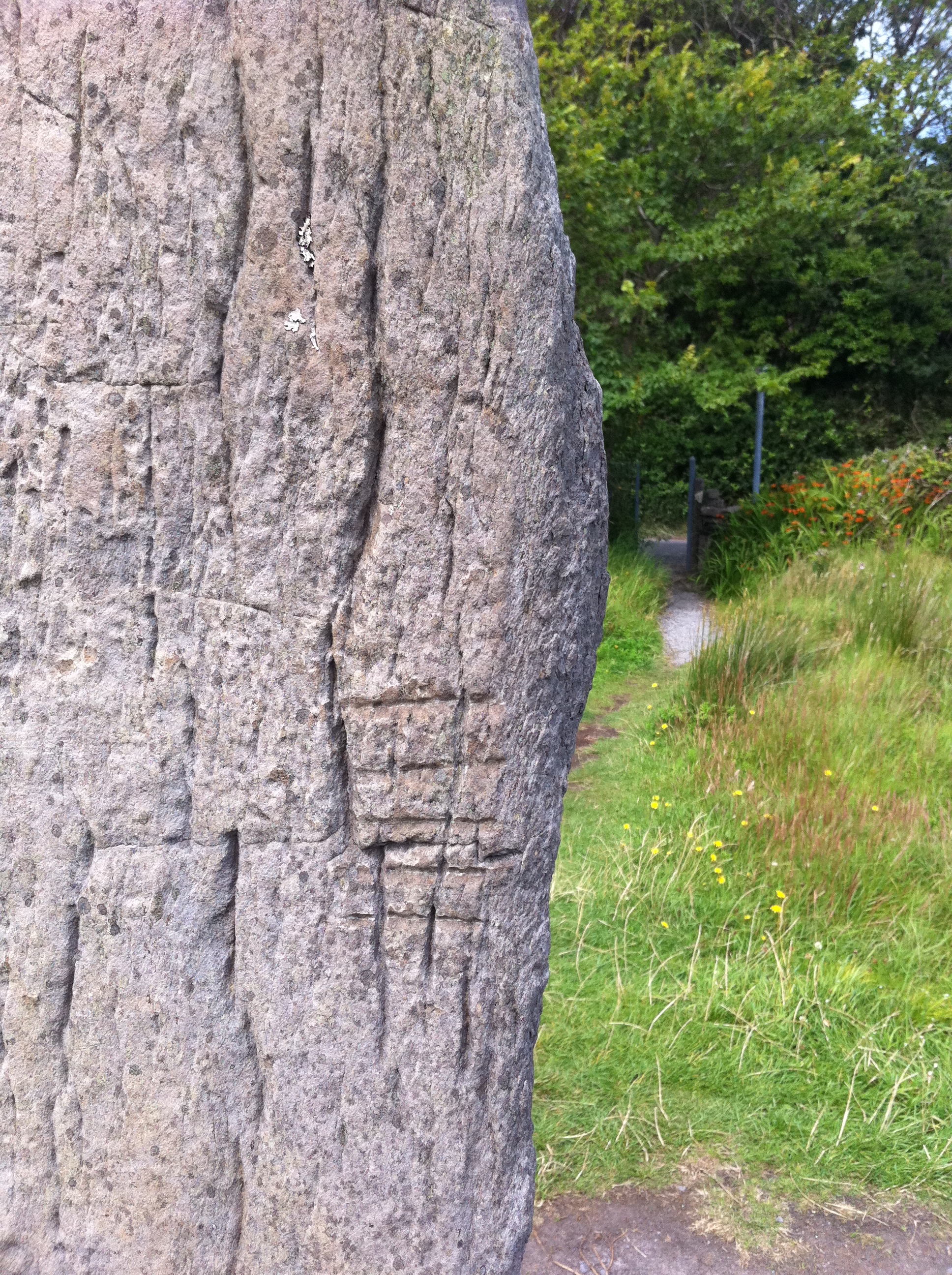
oGham sTones
Ogham (pronounced AGH-m or OH-ehm) is the earliest form of writing in Ireland. It dates to around 4th century A.D. and was in use for around 500 years. The Ogham alphabet is made up of a series of strokes along or across a line. Ogham is sometimes referred to as the “Celtic Tree Alphabet” as most of the letters are linked to old Irish names for certain trees. The alphabet was carved on standing stones to commemorate someone, using the edge of the stone as the centre line. They normally read from the left hand side bottom up, across the top and if need be, down the other side.
I came across this particular Ogham stone in Derrynane, Co. Kerry.
sTone oUthouse
This small stone building can be found at Gleesk Pier in Co. Kerry, which lies about 10km beyond Sneem going in the direction of Derrynane. It is adjacent to a larger stone dwelling so it is likely this smaller building was an outhouse of sorts. To give an idea of size, the doorway is about 5 feet in height. There are many examples of this type of building to be found around the west of Ireland.


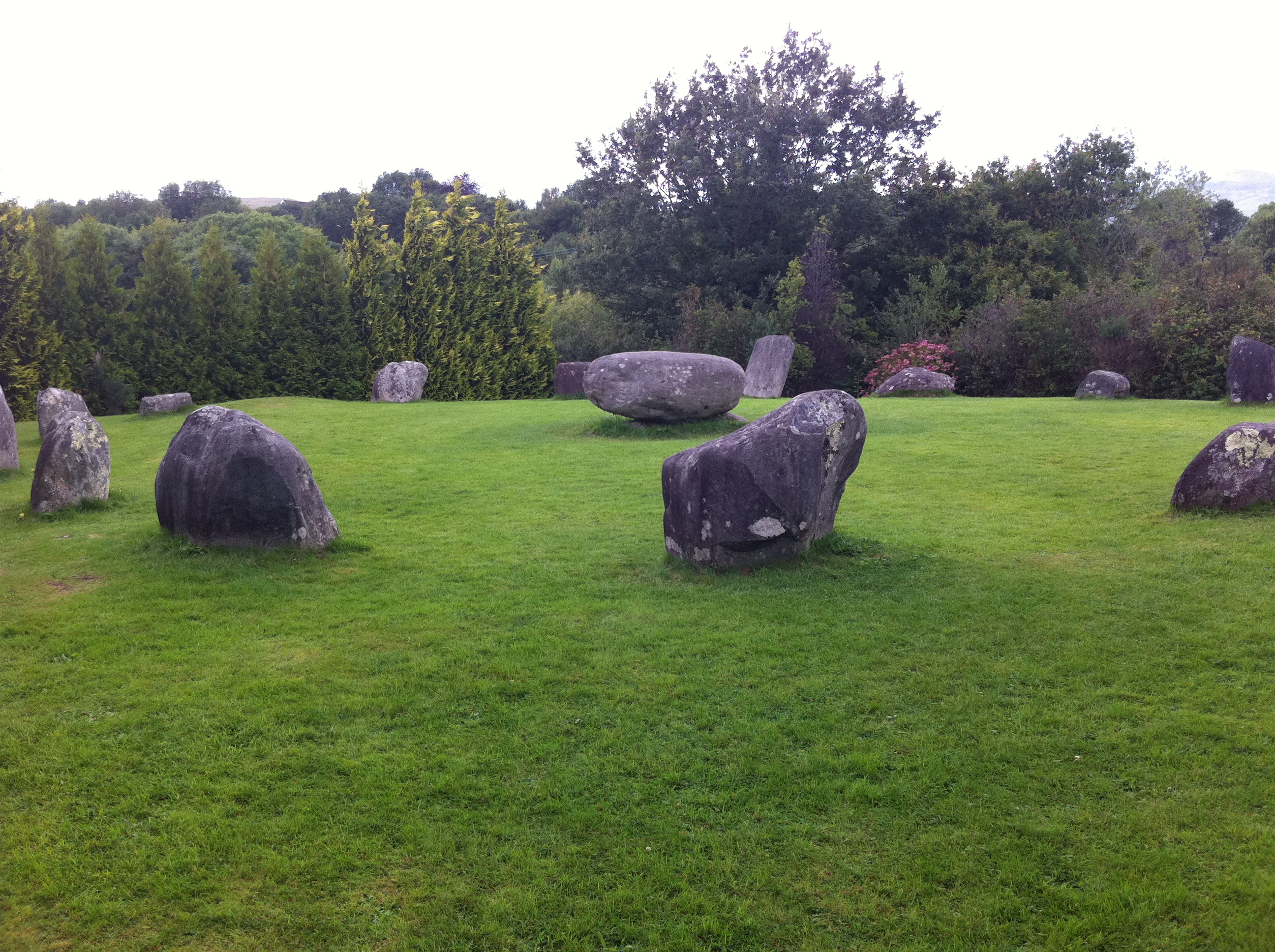
kEnmare sTone cIrcle
The Kenmare Stone Circle is reported to be the biggest in the south west of Ireland. This circle lies in the town of Kenmare itself, not far from the Cromwell Bridge. It is composed of 15 heavy boulders: 13 standing and 2 prostrate at the north. In the centre of the circle is a Boulder Dolmen, which is rather unique. The capstone is some 2m long and 1.8m wide and is estimated to weigh almost 7 tons. Dolmens often marked the burial place of someone important.
Stone Circles were built during the Bronze Age (2,200-500 B.C) for ritual and ceremonial purposes. They were often orientated on certain solar and lunar events , such as the position of the sun on the horizon during a solstice. The Kenmare example may be orientated on the setting sun.
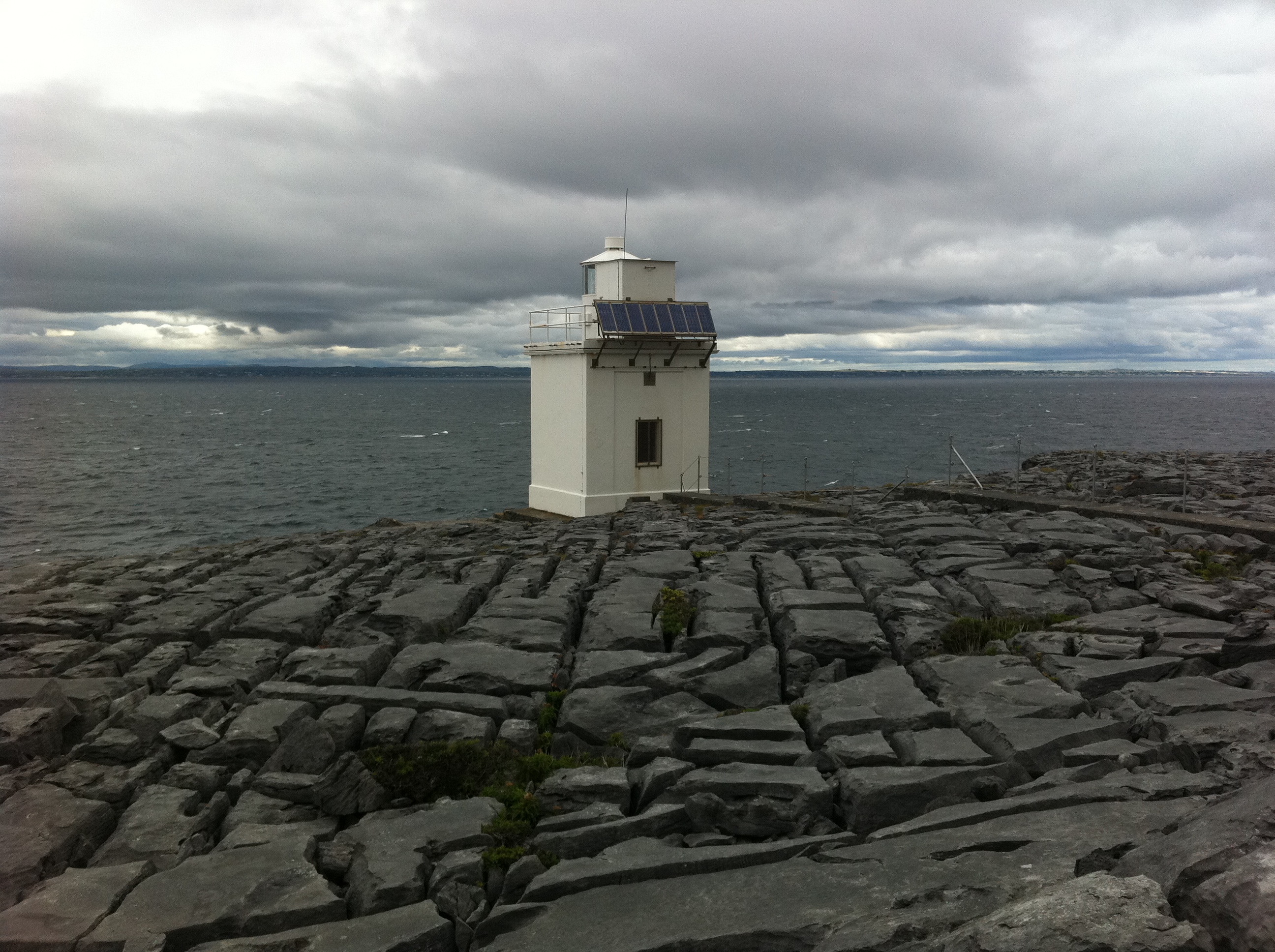
tHe bUrren
The Burren is one of the most fascinating and lovely parts of Ireland. It is a huge limestone plateau with numerous megalithic remains and a protected habitat where many rare plants and flowers grow.
It can look like a barren and stony wasteland in places, but that could not be further from the truth. It’s a place full of history, with a fascinating geology, a paradise for botanists and very much a living place.
The Burren features one of the most spectacular coastal drives in Ireland, with breathtaking views across Galway bay to the Connemara coast and the three Aran Islands of Inis Mor, Inis Meain and Inis Oir. Some of the best views are from the area around Black Head lighthouse which is pictured below fronted by the characteristic limestone landscape.
The Burren is famous for its Flora – its diversity, abundance and rarity. So many botanists visit the area that it is perhaps no surprise that a wide variety of rare plants have been recorded here. The examples shown below are the Harebell (left) and the Crane’s-bill (right).
On the rock behind the Harebell you can see patches of Orange Lichen, which is abundant throughout the area.


Though it may look rugged, the Burren is a fragile place and is under threat from increased human activity.
The people who live in the Burren depend on the landscape for their livelihoods which are largely based on agriculture and tourism. The limestone pavement, flora and built heritage are the resources on which tourism in The Burren thrives. Respecting and conserving this resource will sustain the community’s well-being.

tHe bUrren cOde
The Burren Code is an initiative designed to inform people as to appropriate behaviour when visiting the Burren.
Support the principles of the Burren Code to help safeguard this important landscape:
- Leave the limestone pavement as you find it*
- Preserve natural habitats and leave wildflowers undisturbed.
- Take care not to damage monuments, walls and buildings
- Respect landowners, their property and their livestock
- Park and camp in designated areas
- Leave no trace of your visit, take nothing but memories.
*Limestone Pavement is listed as a “Priority Habitat” in the European Habitats Directive, 1992.

Coming soon: iReland by iPhone – Part 2 – sEa and sAnd
That bridge is a miracle of engineering John. I think there’s at least one other like it in Kerry if I recall correctly.
Brilliant collection John. Always a pleasure to see your shots.
Pingback: iReland by iPhone – Part 2 – sEa and sAnd | Picture This
Pingback: iReland by iPhone – Part 3 – sUn and sHade | Picture This
Pingback: iReland by iPhone – Part 3 – sUmmer fLora | Picture This
Pingback: iReland by iPhone – Part 4 – sUn and sHade | Picture This